Discover How The World Was ‘Mapped’ Over The Centuries At SBA’s ‘Tales From The East’ Exhibition
From maps produced for the kings of Spain and Portugal to a 12th century world map oriented with south at the top and a life-size hand coloured photograph of a 15th century map of the world, the ‘Tales from the East’ exhibition organised by Sharjah Book Authority (SBA) at its headquarters in Sharjah, features a treasure trove of unique exhibits that shed light on the evolution of the science of cartography.
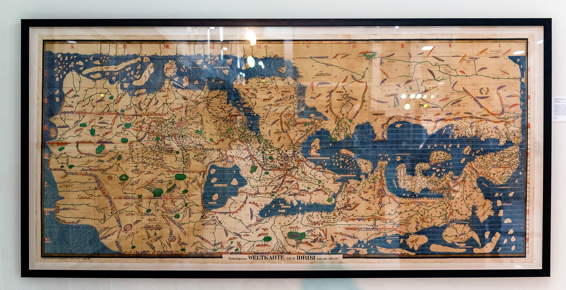
When renowned Muslim scholar and traveller, MuhammadAl-Idrisi, was commissioned by King Roger II – the greatest of the Norman kings of Sicily, to create a map for him of the entire known world, it led to the creation of the magnum opus called the Tabula Rogeriana. Depicting the world from Iceland to China and Africa, and a host of countries in between.
The strikingly detailed Tabula Rogeriana which remained among the world’s most accurate maps for nearly 300 years, featured mountains, lakes, rivers, and towns, as well as roads and distances. However, in the tradition of Islamic cartographers, Al-Idrisi drew it with south positioned at the top.
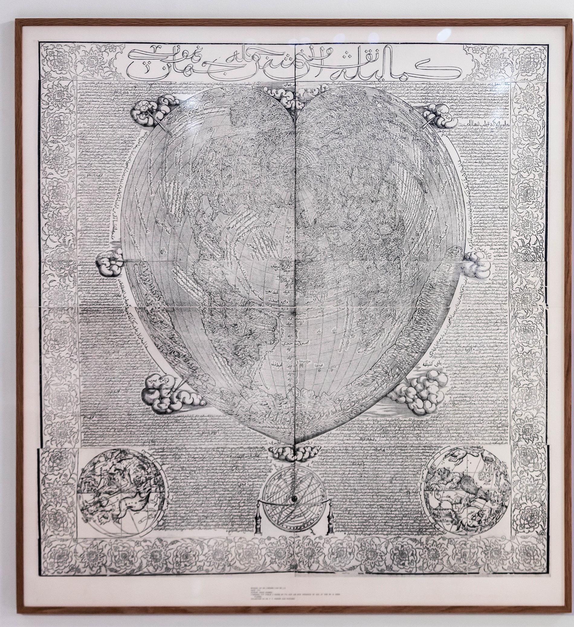
‘Tales from the East’ exhibition also features an equally fascinating example of the significant achievements of early modern cartography with Tunisian Hajji Ahmed’s ‘Fully Illustrated Exposition of the World in Its Entirety,’ created in an unknown workshop in Venice in 1559. A towering landmark of contemporary geographical knowledge, this map is among the most extensive original Turkish-language geographical treatises to have survived from the 16Thcentury.
This cordiform or heart-shaped world map features copious text, intricately and painstakingly inscribed along its outer margins. The text describes the four continents, the 12 great countries of the world paired with signs of the zodiac, as well as the seven greatest rulers in the world paired with planets. Three smaller maps at the bottom depict the celestial world.